Published Jul 2026
Get Directions to a Vehicle or Place
Need to know how far a vehicle is from a job, and how bad the traffic is right now? MapView's Go to directions tool routes from a vehicle to any destination and shows the live ETA.
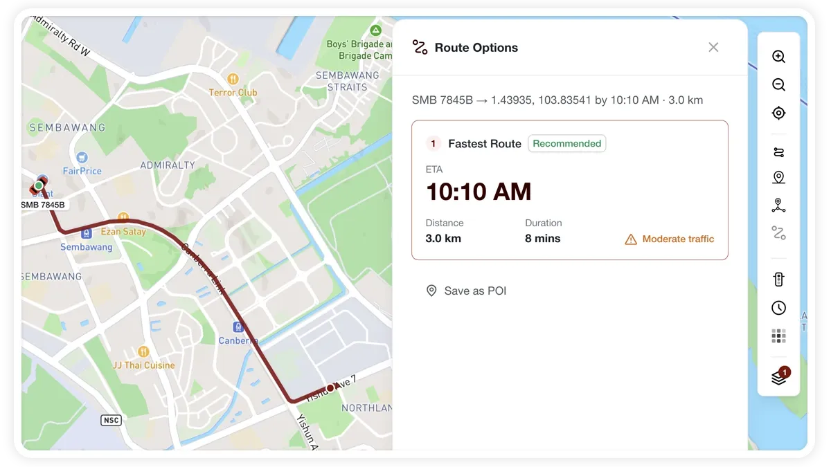
How to get directions
- Select the Go to (directions) button on the right toolbar, or use a POI's directions action.
- Choose a vehicle as the start (From).
- Set the destination (To) using any of these:
- Type an address and pick from autocomplete.
- Use My location (GPS).
- Pick a saved POI.
- Click on the map — MapView reverse-geocodes the point.
- Read the Route Options panel: ETA is the headline, with distance, duration, and the live traffic level below.
What the Route Options panel shows
- ETA — the headline arrival estimate.
- Distance — how far the route runs.
- Duration — how long the trip should take.
- Traffic level — light, moderate, heavy, or severe, from live conditions.
- Save destination as POI — keep the destination for reuse.
- Monitor route — turn the trip into a route fence.
Frequently asked questions
How is the ETA calculated?
Directions and traffic use the map provider's routing, so the ETA reflects live traffic conditions along the route.
Can I keep the destination or the route?
Yes. Use Save destination as POI to reuse the place, or Monitor route to turn the trip into a route fence.
Related
Next
Map Layers, Views & Traffic
Switch between roadmap and satellite views, toggle vehicles, POIs, zones and traffic, and turn on analytics layers from the MapView map.
Learn more about this feature
Explore featureMore in Maps & Geofencing
Didn't find what you needed?Contact support