Published Jul 2026
Create a Geofence (Zone)
A geofence, or zone, is an area you draw on the map. Once saved you can watch it and get alerts whenever a vehicle enters, exits, or lingers inside it.
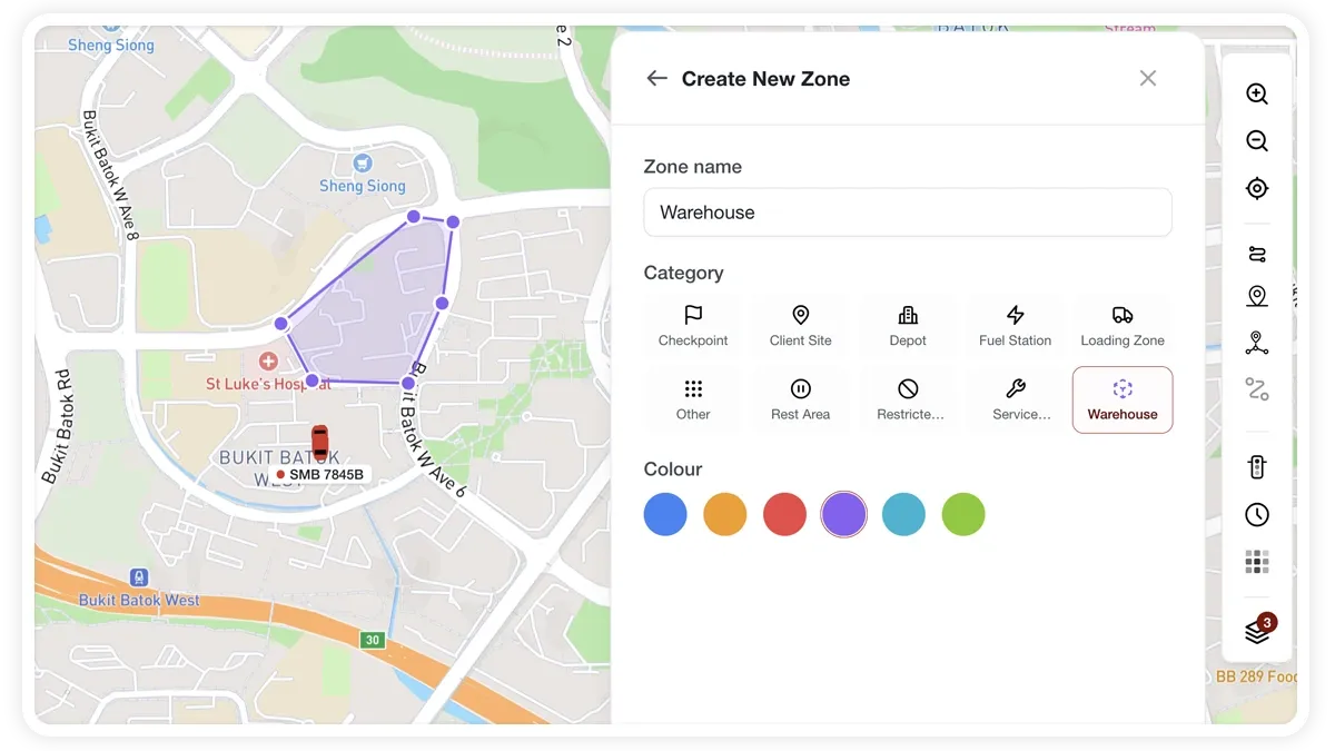
How to create a geofence
- Open the POI tool and choose Draw a zone.
- Pick a shape:
- Polygon — click to drop each point, then close the shape.
- Rectangle — drag a box across the area.
- Circle — drop the centre, then set the radius.
- Give the zone a name, category, and colour.
- Select Save, or Save & Add Another to keep drawing more zones.
What you can set
- Shape — polygon, rectangle, or circle, whichever fits the area best.
- Name — how the zone appears in your saved places and alerts.
- Category — groups the zone with similar places.
- Colour — makes the zone easy to spot on the map.
- Watch toggle — after saving, switch this on to create entry, exit, and dwell alerts.
- Advanced alert rule — this link opens Alerts to fine-tune the rule.
Frequently asked questions
How do I get alerts from a zone?
After saving, switch on the Watch toggle to create entry, exit, and dwell alerts. The Advanced alert rule link opens Alerts if you need to refine the rule.
Can I build a zone from a real city or district boundary?
Yes. Instead of drawing by hand, use boundary search to turn an existing city or district boundary into a geofence, or use a route fence to monitor a corridor a vehicle should follow.
Related
Next
Create a Geofence from a Place Boundary
Auto-draw a geofence from an administrative or place boundary — search a city, district, or suburb and place its polygon instantly instead of drawing by hand.
Learn more about this feature
Explore featureMore in Maps & Geofencing
Didn't find what you needed?Contact support