Published Jul 2026
Create a Geofence from a Place Boundary
Instead of drawing a zone by hand, you can auto-draw a geofence from an administrative or place boundary — a city, district, or suburb. It’s the fastest way to fence a large or oddly-shaped area accurately.
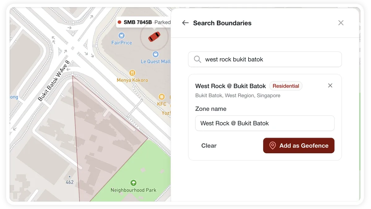
How to create a geofence from a boundary
- Open the zone shape picker and choose Boundaries (or, from the Draw a zone card, use the search).
- Search for a place — a city, district, or suburb.
- Select the matching boundary from the results. Each is shown with its name, type, and address.
- Edit the zone name if you want.
- Click Add as Geofence. The boundary polygon is placed automatically.
- Finish in the normal create-zone form — set the category, colour, and watch options.
What you can set
- Zone name — rename the fence before adding it.
- Category — group the geofence with others of the same kind.
- Colour — how the zone is shown on the map.
- Watch — turn on entry/exit alerts for the zone.
Frequently asked questions
When should I use a boundary instead of drawing?
Use a boundary for large or oddly-shaped areas — a whole city, district, or suburb — where drawing an accurate outline by hand would be slow. For a small site, drawing a circle or polygon is quicker.
Can I still watch a boundary geofence for alerts?
Yes. Because you finish in the normal create-zone form, you can turn on the watch option just like any other geofence.
Related
Next
Watch Dashcam Video with a Trip
Play synced dashcam footage alongside a trip in MapView. On MDVR-equipped vehicles the trip video panel opens automatically with Front, Rear, Cabin, and Side cameras.
Learn more about this feature
Explore featureMore in Maps & Geofencing
Didn't find what you needed?Contact support